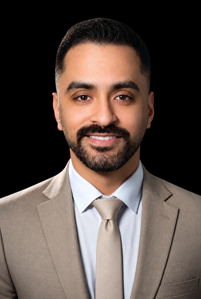
DR. MAHMOUD OSAMA GABALLAH
GIS Specialist | Academic Instructor
TURNING SPATIAL DATA INTO INSIGHTS,
INSIGHTS INTO IMPACT.
WHO I AM
I’m Dr. Mahmoud Osama Gaballah, a GIS and Remote Sensing Specialist and Academic Instructor with a Ph.D. in Applied Geomorphology, based in Egypt.
My work begins with a spatial question: What has changed over time? How accessible are essential services? How does terrain influence drainage and environmental processes? I use GIS, remote sensing, and spatial analysis to structure data, investigate these questions, and turn analytical results into meaningful geographic insights.
My professional experience includes 14 documented GIS projects across Egypt, Iraq, and Saudi Arabia, covering infrastructure data, environmental analysis, urban development, and spatial research.
Alongside my work, I teach GIS and surveying at the Faculty of Arts, Tanta University, where I have mentored more than 6,000 students since 2020. My academic background informs my technical approach: a map or classified image is not the final answer; understanding what the results reveal is what matters.
"I don't just make maps; I build spatial understanding that supports better decisions."
Countries: Egypt, Iraq, Saudi Arabia
GIS Projects
Publications
Students Mentored Since 2020
Ph.D.
Applied Geomorphology, Tanta University
CORE CAPABILITIES
What I Do
Geographic Information Systems
Enterprise geodatabase design through to national-scale spatial intelligence delivery.
- • Geodatabase Architecture & Design
- • CAD-to-GIS Migration
- • Network & Hydrological Analysis
- • Topology & Quality Control
Remote Sensing
Multi-temporal satellite imagery processing for environmental & geomorphological research.
- • Supervised / Unsupervised Classification
- • LULC Analysis & Change Detection
- • Spectral Indices & Earth Observation
- • Google Earth Engine Analytics
GeoAI & Machine Learning
AI-assisted spatial analysis delivering higher accuracy than traditional methods.
- • SVM Machine Learning Models
- • Deep Learning Feature Extraction
- • Geomorphological Dynamics
- • Predictive Spatial Modeling
Environmental Modeling
Advanced simulation for renewable energy, climate analysis, and flood risk.
- • Watershed Delineation
- • Spatial Interpolation (IDW)
- • Wind Rose Analysis
- • Pollution Monitoring Atlases
Mapping & Cartography
Precision thematic cartography for research, urban planning, and policy.
- • Thematic & Choropleth Mapping
- • 3D Terrain Visualization (Surfer)
- • Cartographic Design (Adobe Suite)
- • Digital Environmental Atlases
Surveying & Engineering
Field data acquisition and construction quality control for civil infrastructure.
- • DEM, DTM & TIN Generation
- • Construction Staking & Cut/Fill
- • Total Station & GNSS/GPS
- • Coordinate Systems & Projections
Geographic Research
Applied geomorphological and spatial data research at Ph.D. academic standard.
- • Applied Geomorphology
- • Spatial Statistics (SPSS)
- • Peer-Reviewed Publications
- • Academic & Technical Writing
Teaching & Training
University-level instruction and professional geospatial training at scale.
- • GIS & Remote Sensing Training
- • Curriculum Design & EdTech
- • Capstone Project Supervision
- • Interactive Assessment Methods
Projects
Healthcare Accessibility & Catchment Area Analysis
Assessed emergency access to Tanta University Hospital across Tanta governorate. A topology-checked street-network geodatabase fed routing analysis and drive-time service areas (15, 30, 60, 90 mins).
Challenge: Real travel depends on connectivity, speed limits, and time impedance rather than straight-line distance.
My Role: Engineered street network, enforced topology rules, built geometric network, calculated impedance routing, and modeled service areas.
Tools: ArcGIS Network Analyst, Geometric Network.
Key Outputs: Routable geodatabase, optimal emergency routes, 4 multi-threshold drive-time polygons.
Geodatabase Engineering & 3D Terrain Modeling
Migrated the Government District master plan from CAD into a structured geodatabase, producing terrain, drainage, and hydrological baselines from survey data.
Challenge: Transforming static unstructured CAD geometry into an enterprise-ready As-Built GIS dataset.
My Role: CAD-to-geodatabase migration, DEM/TIN processing, hydrological watershed extraction, and 3D geological modeling in Surfer.
Tools: CAD to Geodatabase, Hydrology Tools, Surfer, TIN/DEM.
Key Outputs: Structured ministry geodatabase, slope/aspect/contour maps, watershed drainage basin models.
LULC Change Detection & Geomorphological Mapping
Supervised classification of Landsat 5 & 7 imagery between 1984 and 2021 combined with 70 years of Black Sand dune movement tracking and DEM elevation profiling.
Challenge: Quantifying long-term coastal geomorphological change and dune migration across multi-decade satellite records.
My Role: Multitemporal supervised classification, 30m DEM slope/aspect profiling, and Black Sand dune digitized distribution analysis.
Tools: Extract by Mask, Supervised Classification, DEM Profiling, Area Calculator.
Key Outputs: LULC maps (1984 & 2021), dune dynamics history (1953–2021), peer-reviewed research outputs.
Climatic & Environmental Atlas — Western Desert
Synthesized 30m DEM with Egyptian Meteorological Authority records through IDW interpolation to create seasonal radiation, pressure, and temperature surfaces.
Challenge: Interpolating climate variables across vast desert areas with sparse meteorological stations.
My Role: DEM processing, seasonal 4-season IDW spatial interpolation, wind rose analysis, and water-well / petroleum mapping.
Tools: IDW Interpolation, Rose.Net, Aspect, Slope, Reclassify.
Key Outputs: 20+ thematic atlas maps, seasonal temperature & radiation models, four wind roses.
Electrical Grid Digital Transformation
Digitized electricity transmission and distribution assets at governorate, district, and municipal scales, integrating 66kV, 220kV, and 500kV grids.
Challenge: Unifying scattered physical utility blueprints into a multi-scale connected spatial dataset.
My Role: High-voltage transmission lines digitization, substation mapping, urban underground cables, and residential overlay analysis.
Tools: Utility Digitization, Topology, Thematic Cartography.
Key Outputs: Multi-scale electricity geodatabase, substation grids, five published thematic maps.
Hydrological Analysis — Tigris & Euphrates Basins
Delineated watershed basins, extracted the Iraqi stream network, and quantified basin geometry alongside dams, borders, and pipeline routing.
Challenge: Extracting transboundary natural basin boundaries based purely on terrain elevation regardless of national borders.
My Role: Hydrological modeling, stream network extraction, basin area calculations, and strategic dam/border digitization.
Tools: ArcGIS Hydrology Tools, Spatial Statistics, Editing.
Key Outputs: Delineated basins, extracted drainage network, six strategic infrastructure maps.
🏙️ Urban Sprawl & Environmental Mapping
Hamoul District, Egypt
Tracked urban growth across 5 Landsat imagery dates (1984–2021) combined with salinity, groundwater, and demographic choropleth maps.
🌿 LULC Classification & Terrain Analysis
Basyoun District, Gharbia, Egypt
Supervised classification of Landsat 8 satellite imagery alongside 30m DEM slope/aspect characterization and academic reporting.
🌡️ Climatic Spatial Interpolation Atlas
Kafr El Sheikh & Aswan, Egypt
Comparative regional climate atlas for Nile Delta and Upper Egypt mapping rainfall, temperature, and humidity across all 4 seasons using IDW.
💧 Water Quality Spatial Interpolation
Rashid Branch, Nile River, Egypt
Converted point river chemistry samples into continuous spatial surfaces via IDW interpolation across 47 thematic environmental maps.
⚡ Urban Energy Consumption Analysis
Zefta City, Gharbia, Egypt
Sub-district spatial analysis of electrical power consumption and grid losses correlated with historic urban expansion between 1940 and 2021.
🏛️ Campus Geodatabase Development
Egypt
Built an enterprise campus spatial database from CAD drawings, enforcing ministry-compliant attribute domains and subtypes.
📊 Statistical Survey Analysis
Saudi Arabia
Cleaned and summarized ten research survey datasets with SPSS, producing descriptive statistical evaluations, charts, and recommendations.
🏫 Educational Services Spatial Analysis
Al-Madain District, Iraq
Prepared 60 spatial indicator maps evaluating population distribution, demographic ratios, literacy levels, and school facility coverage.
Skills
Geographic Information Systems
Remote Sensing & GeoAI
Surveying & Cartography
Academic Instruction & Research
Planning & Instructional Design
Teaching Strategies
Technology & Artificial Intelligence
Soft & Leadership Skills
Personal & Managerial Skills
Software & Tools
Professional Experience
Academic Instructor & Practical Supervisor (GIS & Surveying)
Sep 2020 – PresentFaculty of Arts, Tanta University • Tanta, Egypt
- • Conducted hands-on practical training for cohorts of 600 students/semester, cumulatively mentoring 6,000+ professionals since 2019.
- • Spearheaded specialized training in Coordinate Systems, Geodatabase Architecture, Symbology & Cartographic Design.
- • Supervised graduation capstone projects across the full geospatial lifecycle: field data collection, analytical processing, and publication-standard reporting.
Senior GIS & Remote Sensing Specialist (Freelance)
Nov 2020 – PresentIndependent Geospatial Consultant • Egypt & MENA Region
- • Enterprise Geodatabase Architecture: Delivered ministry-compliant enterprise databases for New Administrative Capital (2025) and Ramses College (2024).
- • GeoAI & Satellite Analytics: Pioneered SVM algorithms for multitemporal satellite classification, 70-year Black Sand dynamics, and coastal change detection.
- • Environmental & Hydrological Modeling: IDW water quality interpolation across Nile branches, Rose.Net wind analysis, and watershed basin delineation.
Site Surveyor
Dec 2017 – Dec 2018Najran Company • Suez, Egypt
- • Orchestrated daily field survey operations to optimize civil construction workflows and prevent project delays.
- • Performed construction staking with volumetric calculations for precise Cut & Fill operations using Total Station and leveling equipment.
ACADEMIC QUALIFICATIONS
Education
Ph.D. in Applied Geomorphology
First Class HonorsTanta University, Egypt • 2020 – 2023
"Man as a Geomorphological Agent on the Northern Coastal Nile Delta Lakes: A Study in Applied Geomorphology."
Master of Arts in Geography
ExcellentTanta University, Egypt • 2016 – 2019
"Physical Controls for Development in the Golden Triangle Region of the Eastern Desert using Remote Sensing & GIS."
Bachelor of Arts in Geography
GOODTanta University, Egypt • 2011 – 2015
Survey & GIS Division
SCIENTIFIC PAPERS
Research & Publications
Using SVM Technique for Monitoring and Assessing Man as a Geomorphological Agent on Lake Manzala (1984–2024)
Third International Scientific Conference: "The Future of Humanities in the New Republic (Post-Digitalization & AI Challenges)".
The Anthropogenic Role in Geomorphological Change of Northern Lakes using AI Techniques
Scientific Journal of the Faculty of Arts, Tanta University, Issue 54.
Spatial Artificial Intelligence (GeoAI) Applications
King Mariout Institutes • Presentation on next-generation spatial computing.
Certifications
Spatial Analysis & Spatial Data Science
Remote Sensing & Imagery
AI, Deep Learning & Programming
3D GIS & Visualization
Geodatabase, Data Management & Quality
Cartography & Geo Apps
Infrastructure, Utility & Environment
Teaching, Leadership & Professional Development
General Skills
LET'S CONNECT
Available for GIS consultancy, academic collaborations, research partnerships, speaking engagements, and professional training programs.